Daily outlook
Strengthening coastal storm to bring a soaking rain to the Northeast Thursday into Friday, with accumulating snow likely in the higher elevations of New York and northern New England
Strengthening coastal storm to bring a soaking rain to the Northeast Thursday into Friday, with accumulating snow likely in the higher elevations of New York and northern New England Much colder air spreads across the eastern half of the nation behind a strong cold front, with heavy lake-effect snow in Michigan's Upper Peninsula Pacific storm system to bring heavy rain, strong winds, and blizzard conditions to the Sierra Nevada to the West Coast on Friday
National outlook · 1
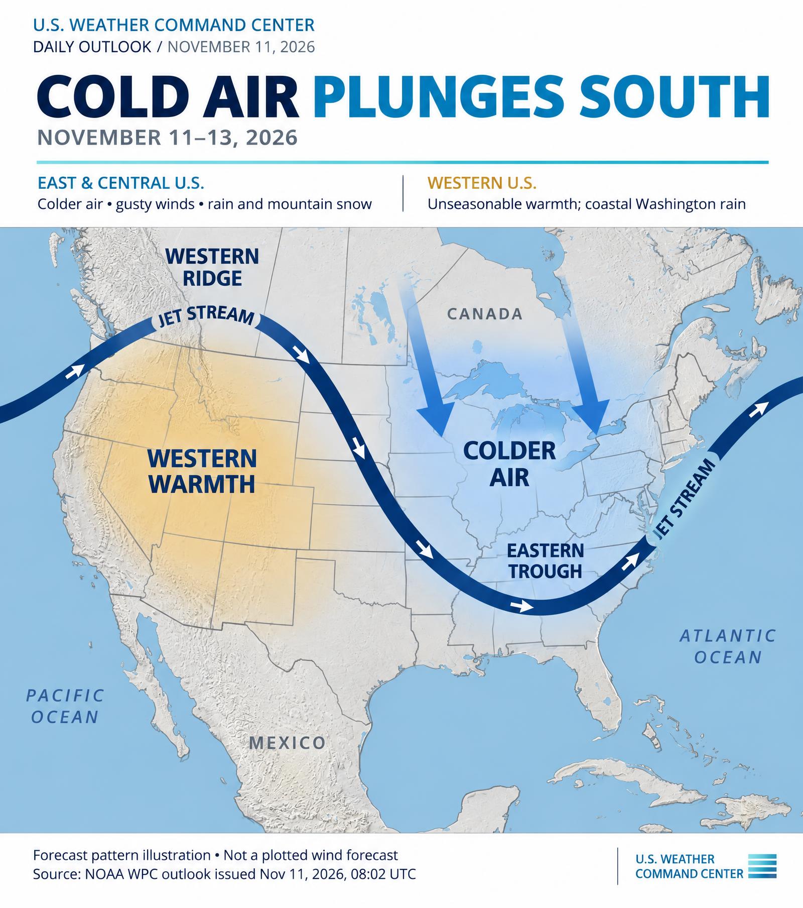
A deepening upper-level trough over the eastern U.S. will drive a strong cold front through the Ohio and Tennessee Valleys this evening, with scattered thunderstorms along the front. A few of these storms could produce damaging winds before weakening late this evening. The associated area of low pressure will move east across the Mid-Atlantic on Thursday and then strengthen off of the New Jersey coast. It is expected to track northeastward near Cape Cod and into the Canadian Maritimes by Saturday. A prolonged period of rain will spread across the Northeast on Thursday and continue into Friday, with gusty winds and minor coastal flooding possible around high tide along parts of the coast near New York City. As colder air wraps around the storm, rain will change to snow Thursday night and Friday over the higher terrain of New York, northeastern Pennsylvania, and northern New England. Accumulating snow and slick travel are likely at elevation, while lower elevations and valleys will mostly see rain or a brief mix. Snow could also fall in the southern and central Appalachians from Thursday night into the weekend, with some areas seeing their first snowflakes of the season.
National outlook · 2
Behind the front, a much colder air mass will spread from the Plains to the East Coast. High temperatures will run well below normal by Friday, and overnight lows will fall into the 20s across much of the central U.S. This sets the stage for a widespread frost and freeze across the South and Southeast this weekend. Cold northwest winds crossing the relatively warm Great Lakes will produce rounds of lake-effect rain and snow through Friday. The heaviest snow is expected over the higher terrain of Michigan's Upper Peninsula, where significant accumulations are possible. Gusty winds and very dry air behind the front will also raise fire danger across parts of the lower Mississippi Valley and central Gulf Coast.
National outlook · 3
In the west, warm and dry conditions will continue through Thursday, with near-record highs possible in parts of the Northwest and Great Basin. The pattern will turn much more active on Friday as a strong Pacific storm system and a plume of subtropical moisture move ashore. Moderate to heavy rain and strong south winds are expected across northern California and the Pacific Northwest. Heavy snow and strong winds will create blizzard conditions over the higher elevations of the Sierra Nevada, making travel dangerous to impossible. Strong winds will also spread into the Great Basin, and a separate system moving in from Baja California will bring showers to southern California, locally heavy near the coast, late Thursday into Friday.
Sources & issue dates
Source links show the latest discussion and may differ from the dated issues used for this article.
- NOAA WPC Short Range Forecast Discussion
Issued 255 PM EST Wed Nov 11 2026