Skip to content
US WEATHERCommand Center

The weather journal

Weather Stories

The patterns behind the forecast. A closer look at the weather shaping our week.

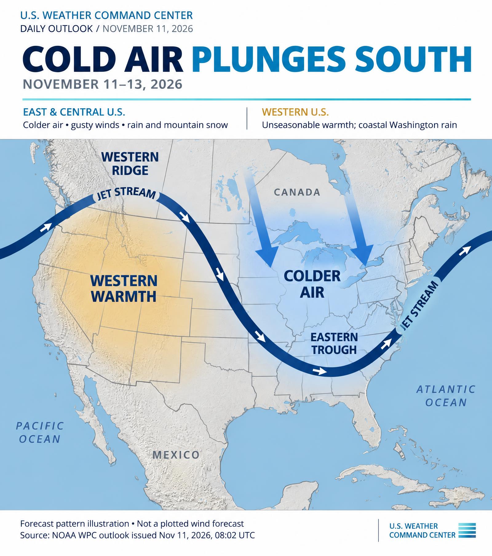
November 11–13 forecast pattern illustration: a western jet-stream ridge and eastern trough, with blue arrows showing colder Canadian air plunging south into the central and eastern United States
Daily outlook

Strengthening coastal storm to bring a soaking rain to the Northeast Thursday into Friday, with accumulating snow likely in the higher elevations of New York and northern New England

Strengthening coastal storm to bring a soaking rain to the Northeast Thursday into Friday, with accumulating snow likely in the higher elevations of New York and northern New England Much colder air spreads across the eastern half of the nation behind a strong cold front, with heavy lake-effect snow in Michigan's Upper Peninsula Pacific storm system to bring heavy rain, strong winds, and blizzard conditions to the Sierra Nevada to the West Coast on Friday

Outlook period: 00Z Thu Nov 12 2026 - 00Z Sat Nov 14 2026

Read story
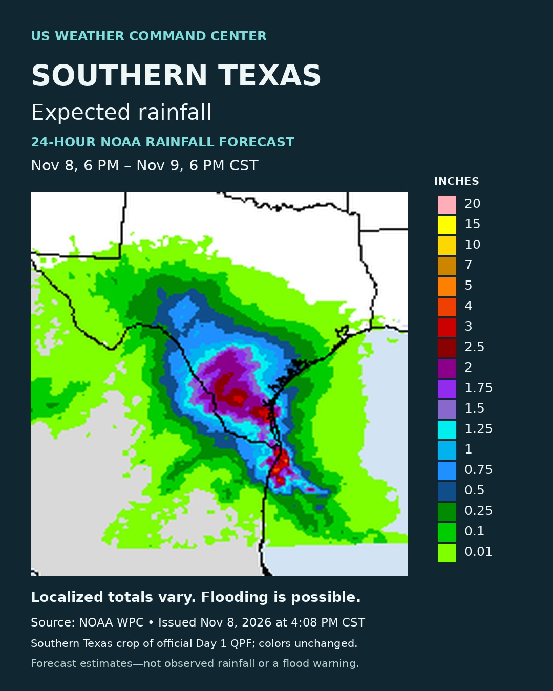
NOAA WPC estimated rainfall across southern Texas for November 8 at 6 PM through November 9 at 6 PM CST, with a color scale in inches
Daily outlook

Heavy rainfall and flash flood threat peaks across southern Texas today into Monday morning

Heavy rainfall and flash flood threat peaks across southern Texas today into Monday morning Active Pacific storm track will bring periods of rain to the Pacific Northwest through the next couple of days Conditions across the country will continue trending mild to unseasonably warm following one more chilly night in the Southeast

Outlook period: 00Z Mon Nov 09 2026 - 00Z Wed Nov 11 2026

Read story

Stories reflect the source dates shown, not live forecasts. For current conditions and official alerts, check your local forecast and the National Weather Service.